University of Minnesota
http://www.umn.edu/
612-625-5000
http://www.umn.edu/
612-625-5000
Minnesota Biodiversity Atlas
Bell Museum
Dataset: MIN-Plants
Taxa: Scirpus atrovirens
Search Criteria: excluding cultivated/captive occurrences
Bell Museum plants | |
 MIN:Plants | 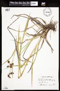 Scirpus atrovirens Willdenow 910994[1021819]Smith, Welby 245171994-06-29 United States, Minnesota, Polk, Polk County...Rydell National Wildlife refuge, about 3 miles southeast of Mentor...T 148N R 43W NW1/4 of SE1/4 of Sec 2;Rydell National Wildlife Refuge;148N;43W;02, 47.6625 -96.0977778 |
MIN:Plants | 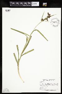 Scirpus atrovirens Willdenow 435129[1021818]Myhre, K. 68661997-07-08 United States, Minnesota, Carlton, Carlton Co.; Cole Lake located 2 miles southwest of the town of Wright. Plants occur along the northwest bays of etc.;;048N;21W;7, 46.658395 -93.053682 |
MIN:Plants | 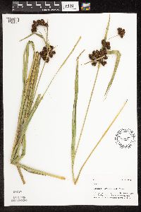 Scirpus atrovirens Willdenow 494052[1106823]Mason, Harriet; Mason, Charles NSP98-991998-07-20 United States, Minnesota, Rice, Near road, north of east transformer. SW corner of section;Nerstrand Woods State Park;110N;19W;16, 44.334371 -93.111203 |
MIN:Plants | 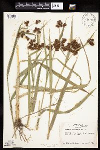 Scirpus atrovirens Willdenow 524442[1021827]Benner, J. s.n.1948-07-15 United States, Wisconsin, Polk, Island five miles north of St. Croix Falls;Saint Croix National Riverway;;;, 45.488738 -92.698239 |
MIN:Plants | 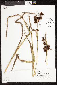 Scirpus atrovirens Willdenow 463592[1106822]Mason, Harriet; Mason, Charles NSP98-1041998-07-28 United States, Minnesota, Rice, Releve N98-02. Just west of the SE most birdhouse. N of set of stakes and S of a slight draw draining to the NE. SW corner of section;Nerstrand Woods State Park;110N;19W;16, 44.334371 -93.111203 |
MIN:Plants | Scirpus atrovirens Willdenow 485035[]Gerdes, Lynden; et al. 31571998-08-13 United States, Minnesota, Cook, Height of Lake Portage between North Lake and South Lake.;Boundary Waters Canoe Area Wilderness / Superior National Forest;065N;02W;22, 48.096204 -90.566242 |
MIN:Plants | 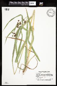 Scirpus atrovirens Willdenow 913535[1021820]Smith, Welby 228691993-07-14 United States, Minnesota, Sibley, Vale Wildlife Management Area. Sibley County... Vale State Wildlife Management Area; ca 2.5 miles N-NW of Henderson; in the valley of High Island... Creek, ca 2.5 miles SW of its confluence with the Minn R... T113N R26W NE1/4 of SW1/4 of Sec 27. 113N 26W 27, 44.5625 -93.9427778 |
MIN:Plants | 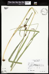 Scirpus atrovirens Willdenow 511084[1021822]Wheeler, Gerald 174701997-08-30 United States, Minnesota, Nicollet, Nicollet County ... Ca. 2.5 mi. NW of Courtland on Rte. 14; Red Rock area ... Bordering the Minnesota River ... E1/2 SE1/4 SW1/4 Sec. 34 T110N R30W (Courtland 34). 110N 30W 34, 44.286852 -94.423968 |
MIN:Plants | 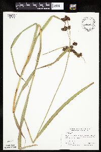 Scirpus atrovirens Willdenow 454162[1021816]Myhre, K. 71831997-08-11 United States, Minnesota, Stearns, Stearns County ... Fuller Lake. Located 4 miles southeast of St. Cloud ... T123N R27W SW1/4 of NW1/4 of Sec 34;;123N;27W;34, 45.413724 -94.057956 |
MIN:Plants | 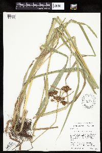 Scirpus atrovirens Willdenow 461612[1021823]Schik, K. 95-1101995-08-22 United States, Minnesota, Clay, SE1/4 of SW1/4 of section;Felton Wildlife Management Area;141N;46W;13, 47.027886 -96.447094 |
MIN:Plants | Scirpus atrovirens Willdenow 432625[]Gerdes, Lynden 36971999-08-02 United States, Minnesota, Cook, Cross River area. Approximately 0.5 mile north on FR 1347 from its junction with the Gunflint Trail (Cty. 12). NE NE of section.;Superior National Forest;065N;04W;26, 48.084497 -90.803753 |
MIN:Plants | 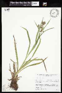 Scirpus atrovirens Willdenow 485001[1021821]Gerdes, Lynden; et al. 28921998-07-09 United States, Minnesota, Cook, Boundary Waters Canoe Area Wilderness / Superior National Forest. T65N R03E S29SESE. Cook County ... Superior National Forest, BWCAW. Near the NW end of the East Pike Lake and John Lake portage.. 065N 03E 29, 48.086768 -90.089692 |
MIN:Plants | 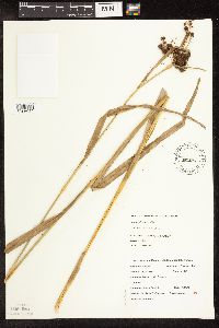 Scirpus atrovirens Willdenow 509291[1106054]DeMink, L. 5001999-09-19 United States, Minnesota, Morrison, [no further data];Crane Meadows National Wildlife Refuge;;;, 45.9667 -94.3667 |
MIN:Plants | 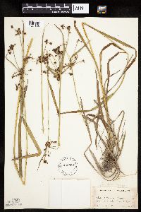 Scirpus atrovirens Willdenow 485559[1021826]Rand, Edward s.n.1891-08-20 United States, Maine, Hancock, Mount Desert Island ... between Seal Cove x Pretty marsh;Acadia National Park |
MIN:Plants | 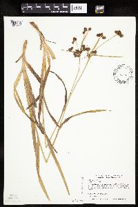 Scirpus atrovirens Willdenow 477410[1021817]Myhre, K. 70021997-07-24 United States, Minnesota, Carlton, Kettle Lake Wildlife Management Area. Carlton County ... Kettle Lake. Located 5 miles southeast of the town of Cromwell. Plants occur along the northwest bay of the lake ... T 48N R 18W NE1/4 of NE1/4 of Sec 19 [note: Kettle Lake is in R19]. 048N 19W 19, 46.628384 -92.797926 |
MIN:Plants | 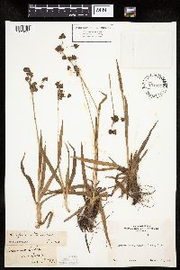 Scirpus atrovirens Willdenow 234824[1021825]Congdon, J. s.n.1890-08-10 United States, California, Mariposa, Crescent Lake, Mariposa County;Yosemite National Park |
MIN:Plants | 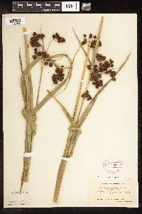 Scirpus atrovirens Willdenow 264485[1105984]Holzinger, John s.n.1897-07-00 United States, Minnesota, Winona, Winona Co.;;N;;, 43.934526 -91.690349 |
MIN:Plants | 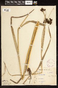 Scirpus atrovirens Willdenow 265349[1106000]Goldsmith, G. G3311912-00-00 United States, Minnesota, Rice, Northfield.;;N;;, 44.458298 -93.161604 |
MIN:Plants |  Scirpus atrovirens Willdenow 265524[1105991]Goldsmith, G. G3311912-00-00 United States, Minnesota, Rice, Northfield.;;N;;, 44.458298 -93.161604 |
MIN:Plants |  Scirpus atrovirens Willdenow 275972[1106016]Grant, Martin 31101929-08-18 United States, Minnesota, Clearwater, Peace Pipe Springs, Itasca Park.;Itasca State Park;143N;36W;, 47.19557 -95.233216 |
MIN:Plants |  Scirpus atrovirens Willdenow 304418[1105998]Linnaean Club, U of M, 2391942-06-26 United States, Minnesota, Rice, Nerstrand Woods. Rice Co.;Nerstrand Woods State Park;110N;19W;, 44.327064 -93.100886 |
MIN:Plants |  Scirpus atrovirens Willdenow 306824[1105987]Moyle, J. 24021935-09-17 United States, Minnesota, Saint Louis, Along Elm Creek.;;N;;, 48.03819 -92.93876 |
MIN:Plants |  Scirpus atrovirens Willdenow 333556[1106012]Oestlund, O. 564-41888-08-14 United States, Minnesota, Hennepin, [no further data];;;;, 45 -93.47 |
MIN:Plants |  Scirpus atrovirens Willdenow 337017[1106020]Lakela, Olga 17411936-08-19 United States, Minnesota, Saint Louis, Near N breakwater, U.S Govt. Property, Duluth.;;050N;14W;20, 46.800337 -92.142643 |
MIN:Plants |  Scirpus atrovirens Willdenow 348158[1106083]Jukkola, E. 421937-06-24 United States, Minnesota, Hennepin, East River Road, S of the Botany Building, Minneapolis.;;N;;, 44.97439 -93.23796 |
MIN:Plants |  Scirpus atrovirens Willdenow 349752[1105965]McCartney, James 581938-06-28 United States, Minnesota, Scott, Minnesota River, between s.t.n. [highway] #50 and Savage.;;;;, 44.78592 -93.3407 |
MIN:Plants | 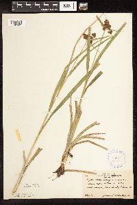 Scirpus atrovirens Willdenow 350184[1105983]McCartney, James 421938-06-28 United States, Minnesota, Scott, Minnesota River, between s.t.n. [highway] #50 and Savage.;;;;, 44.78592 -93.3407 |
MIN:Plants | 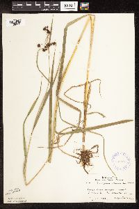 Scirpus atrovirens Willdenow 362896[1106019]Lakela, Olga 40411940-08-13 United States, Minnesota, Carlton, Near Holyoke.;;N;;, 46.467443 -92.388528 |
MIN:Plants | 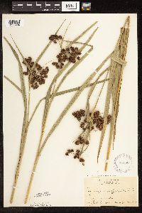 Scirpus atrovirens Willdenow 364285[1106084]Holzinger, John s.n.1897-07-00 United States, Minnesota, Winona, Winona Co.;;N;;, 43.934526 -91.690349 |
MIN:Plants | 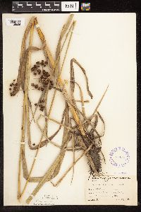 Scirpus atrovirens Willdenow 365009[1105986]Buell, Murray 20281940-08-19 United States, Minnesota, Clearwater, Squaw Lake, Itasca Park.;Itasca State Park;143N;36W;, 47.19557 -95.233216 |
MIN:Plants | 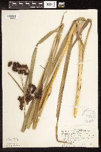 Scirpus atrovirens Willdenow 366165[1105964]Rosendahl, C.; et al. 72621939-07-21 United States, Minnesota, Mower, On a railroad right-of-way, near Taopi.;;;;, 43.558021 -92.64268 |
MIN:Plants | 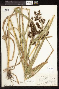 Scirpus atrovirens Willdenow 385590[1105968]Rosendahl, C. s.n.1944-07-14 United States, Minnesota, Fillmore, About 1 1/2 mi S of Fountain. Along hwy. 52.;Dorer Memorial Hardwood State Forest;103N;11W;, 43.717407 -92.149379 |
MIN:Plants |  Scirpus atrovirens Willdenow 385854[1106009]Moyle, J. 39051945-08-30 United States, Minnesota, Mower, Along Deer Creek.;;N;;, 43.70586 -92.54951 |
MIN:Plants | 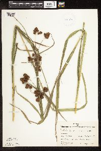 Scirpus atrovirens Willdenow 385856[1105962]Moyle, J. 40301945-08-01 United States, Minnesota, Freeborn, Albert Lea Lake.;;N;;, 43.622436 -93.302598 |
MIN:Plants | 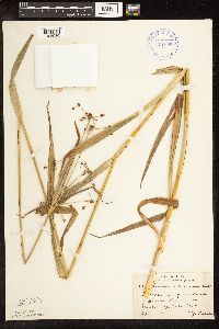 Scirpus atrovirens Willdenow 391866[1105980]Lakela, Olga 62511945-09-16 United States, Minnesota, Lake, Beaver River at Beaver Bay.;;055N;08W;, 47.250316 -91.359973 |
MIN:Plants | 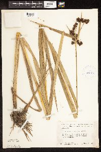 Scirpus atrovirens Willdenow 412436[1106053]Moore, John; Moore, Marjorie 120581939-08-23 United States, Minnesota, Koochiching, Koochiching Co.; On the west bank of the Big Fork River, near the mouth, Reedy Township.;;070N;26W;, 48.512778 -93.671436 |
MIN:Plants | 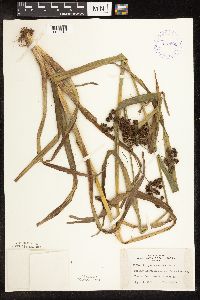 Scirpus atrovirens Willdenow 419591[1106042]Lakela, Olga 119801950-09-04 United States, Minnesota, Saint Louis, On Jay Cooke Park Rd, Fond Du Lac, Duluth.;;N;;, 46.659664 -92.273248 |
MIN:Plants | 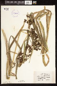 Scirpus atrovirens Willdenow 419604[1105979]Lakela, Olga 119091950-09-01 United States, Minnesota, Saint Louis, Savanna River bank at Floodwood.;;051N;20W;, 46.91894 -92.9176 |
MIN:Plants | 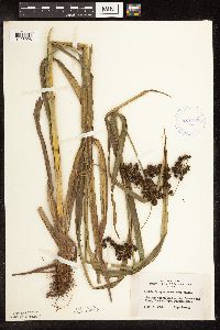 Scirpus atrovirens Willdenow 421293[1106026]Lakela, Olga 119801950-09-04 United States, Minnesota, Saint Louis, On Jay Cooke Park Rd, Fond du Lac, Duluth.;;N;;, 46.659664 -92.273248 |
MIN:Plants | 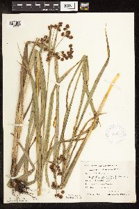 Scirpus atrovirens Willdenow 425847[1106087]Emanuel, J. 5621951-08-04 United States, Minnesota, Winona, Prairie Island bridge, 2 mi. E of Minnesota City.;;107N;07W;, 44.082463 -91.703484 |
MIN:Plants | 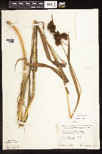 Scirpus atrovirens Willdenow 426028[1106086]Moyle, J. s.n.1951-07-20 United States, Minnesota, Crow Wing, Mission Pond, near Brainerd.;;N;;, 46.348453 -94.240593 |
MIN:Plants | 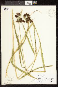 Scirpus atrovirens Willdenow 430655[1105954]Scott, P. 10011997-08-11 United States, Minnesota, Cook, Cook Co. Ditch by County Road 7 about 1 1/4 miles west of the Gunflint Trail T61N R1E sec. 19 SWNENE.;North Shore / Superior National Forest;061N;01E;19, 47.751863 -90.371807 |
MIN:Plants |  Scirpus atrovirens Willdenow 432928[1106003]Myhre, K. 59381995-07-25 United States, Minnesota, Mahnomen, White Earth Indian Reservation / White Earth State Forest. Mahnomen Co.; Located 7 miles southwest of the town of Nay-tah-waush. Plants occur along the north shore of McCraney Lak Mahnomen Co.; Located 7 miles southwest of the town of Nay-tah-waush. Plants occur along the north shore of McCraney Lake; T 143N R 40W SW1/4 of NW1/4 of sec 25. 143N 40W 25, 47.17198 -95.70396 |
MIN:Plants | 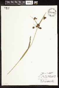 Scirpus atrovirens Willdenow 432929[1106074]Myhre, K. 61681995-08-27 United States, Minnesota, Aitkin, Aitkin Co.; Located 3 miles southeast of the town of Aitkin; northwest shores of Little Hansen Lake; T 47N R 26W NW1/4 o Aitkin Co.; Located 3 miles southeast of the town of Aitkin; northwest shores of Little Hansen Lake; T 47N R 26W NW1/4 of NW1/4 of Sec 33. 047N 26W 33, 46.511982 -93.632861 |
MIN:Plants | 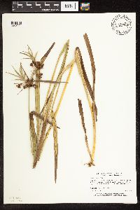 Scirpus atrovirens Willdenow 432946[1105994]Myhre, K. 60971995-08-15 United States, Minnesota, Aitkin, Solana State Forest. Aitkin Co.; Located 9 miles northwest of the town of McGrath. Plants occur along the shores of Porcupine Lake; T 45N R 2 Aitkin Co.; Located 9 miles northwest of the town of McGrath. Plants occur along the shores of Porcupine Lake; T 45N R 24W SE1/4 of SW1/4 of Sec 13. 045N 24W 13, 46.383352 -93.316264 |
MIN:Plants | 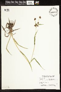 Scirpus atrovirens Willdenow 433233[1106013]Myhre, K. 58391995-07-06 United States, Minnesota, Aitkin, Aitkin County...Located 2.5 miles southeast of the town of Giese. Plants occur along the south bay of Big Pine Lake...T 43N R 22W SW1/4 of NE1/4 of sec 24. 043N 22W 24, 46.194601 -93.064481 |
MIN:Plants | 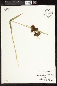 Scirpus atrovirens Willdenow 433281[1106073]Myhre, K. 59701995-07-26 United States, Minnesota, Mahnomen, White Earth Indian Reservation. Mahnomen Co.; Located 2 miles northeast of the town of Waubun. Plants occur along the north shore of Waubun Lake; T 143N Mahnomen Co.; Located 2 miles northeast of the town of Waubun. Plants occur along the north shore of Waubun Lake; T 143N R 41W NW1/4 of NW1/4 of Sec 16. 143N 41W 16, 47.20116 -95.879151 |
MIN:Plants | 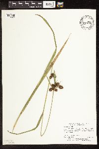 Scirpus atrovirens Willdenow 433497[1106072]Myhre, K. 60031995-08-02 United States, Minnesota, Mahnomen, White Earth Indian Reservation / White Earth State Forest. Mahnomen Co.; LOcated 2 miles southeast of North Twin Lake. Plants occur along the northwest shore of Bass Lake; T 143N Mahnomen Co.; LOcated 2 miles southeast of North Twin Lake. Plants occur along the northwest shore of Bass Lake; T 143N R 39W SW1/4 of NE1/4 of Sec 3. 143N 39W 3, 47.235785 -95.614533 |
MIN:Plants | 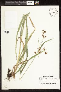 Scirpus atrovirens Willdenow 441716[1106056]Lee, Michael MDL3351993-08-23 United States, Minnesota, Dakota, Dakota Co.; Chub Lake; T 113N R 20W NE1/4 of SW1/4 of Sec 28;;113N;20W;28, 44.565543 -93.22792 |
MIN:Plants | 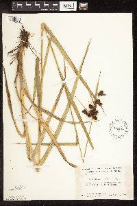 Scirpus atrovirens Willdenow 448745[1106081]Moore, John; Hall, Robert 166911944-08-01 United States, Minnesota, Aitkin, 1/4 mi. E of Aitkin.;;047N;27W;, 46.547376 -93.745854 |
MIN:Plants | 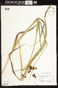 Scirpus atrovirens Willdenow 456820[1105955]Boe, J. 930804041993-08-04 United States, Minnesota, Cass, Cass Co.; near Pike Bay of Cass Lake; along powerline; T 145N R 31W SW1/4 of NW1/4 of Sec 27;Chippewa National Forest / Leech Lake Indian Reservation;145N;31W;27, 47.345035 -94.597113 |
MIN:Plants | 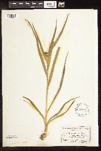 Scirpus atrovirens Willdenow 457860[1106082]Garrison, O. s.n. United States, Minnesota, Upper Mississippi;;;;, 47.2181 -95.2072 |
MIN:Plants | 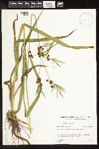 Scirpus atrovirens Willdenow 458744[1106015]Gerdes, Lynden 23061997-08-11 United States, Minnesota, Aitkin, Aitkin Co.; T50N R22W S06NENW. Aitkin Co.; Savanna State Park, NE of Savanna Lake along forest trail.;Savanna Portage State Park;050N;22W;6, 46.845996 -93.17745 |
MIN:Plants | 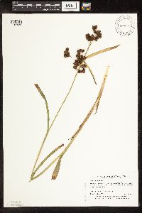 Scirpus atrovirens Willdenow 473667[1105958]Myhre, K. 30611992-08-14 United States, Minnesota, Cass, Cass Co.; Located one quarter mile southwest of Blackwater Lake. Plants growing along the north shore of Island Lake; T Cass Co.; Located one quarter mile southwest of Blackwater Lake. Plants growing along the north shore of Island Lake; T 140N R 29W NE1/4 of SE1/4 of Sec 34. 140N 29W 34, 46.899245 -94.331609 |
MIN:Plants | 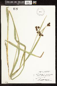 Scirpus atrovirens Willdenow 473668[1105957]Myhre, K. 31001992-08-17 United States, Minnesota, Cass, Cass Co.; Located one quarter mile southeast of Sylvan Lake. Plants growing along the north bank of the Crow Wing River; Cass Co.; Located one quarter mile southeast of Sylvan Lake. Plants growing along the north bank of the Crow Wing River; T 133N R 29W SW1/4 of NE1/4 of Sec 30. 133N 29W 30, 46.306307 -94.377214 |
MIN:Plants | Scirpus atrovirens Willdenow 514526[]Myhre, K. 27221992-07-15 United States, Minnesota, Cass, Cass Co.; located directly W of the Hay Lake public access; growing in a channel between two hills that runs from one la Cass Co.; located directly W of the Hay Lake public access; growing in a channel between two hills that runs from one lake to another; T139N R29W NE1/4 of SW1/4 of Sec 12. 139N 29W 12, 46.870211 -94.289623 |
MIN:Plants | Scirpus atrovirens Willdenow 519250[]Scott, P. 7761993-08-21 United States, Minnesota, Cook, Near Spen Lake...path E of Spen Lake.;Superior National Forest;064N;01W;3, 48.054937 -90.437087 |
MIN:Plants | Scirpus atrovirens Willdenow 520506[]Myhre, K. 44321993-08-10 United States, Minnesota, Pine, One quarter mile north of Mallard Lake. SW1/4 of NW1/4 of section;Saint Croix State Forest;041N;16W;16, 46.033838 -92.373139 |
MIN:Plants | 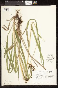 Scirpus atrovirens Willdenow 560723[1106010_1;1106010_2]Ownbey, Gerald; et al. 22491955-07-07 United States, Minnesota, Clearwater, Clearwater County...5.6 mi. N, 3 mi. E of Clearbrook, at the bridge crossing Clearwater River, N-S Road.;;;;, 47.804279 -95.386793 |
MIN:Plants | 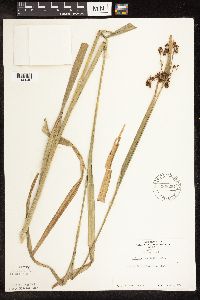 Scirpus atrovirens Willdenow 568294[1106040]Hanson, H. Theo s.n.1940-10-07 United States, Minnesota, Ramsey, Shadow Falls, St. Paul.;Shadow Falls Park;028N;23W;05, 44.942188 -93.197167 |
MIN:Plants | 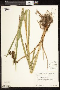 Scirpus atrovirens Willdenow 592059[1105961]Moore, John 266931964-06-18 United States, Minnesota, Houston, 1 mi. N of Brownsville.;Dorer Memorial Hardwood State Forest;103N;04W;, 43.71854 -91.317395 |
MIN:Plants | 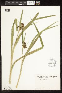 Scirpus atrovirens Willdenow 602215[1105999]Westkaemper, Remberta s.n.1962-06-00 United States, Minnesota, Stearns, Stearns Co. St. Joseph.;;124N;29W;, 45.543642 -94.322053 |
MIN:Plants | 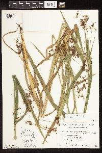 Scirpus atrovirens Willdenow 616789[1106090]Moore, John; Moore, Marjorie 4831969-09-11 United States, Minnesota, Crow Wing, At the S end of Chandler Lake, Garrison Twp.;;N;;22, 46.27899 -93.863336 |
MIN:Plants |  Scirpus atrovirens Willdenow 622256[1105997]Westkaemper, Remberta s.n.1970-07-00 United States, Minnesota, Stearns, Stearns Co. St. Joseph.;;124N;29W;, 45.543642 -94.322053 |
MIN:Plants | 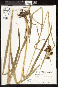 Scirpus atrovirens Willdenow 669980[1106055]Grimm, Eric 821974-08-08 United States, Minnesota, Hennepin, Hennepin County...On the SW side of the road leading into YMCA Camp Ihduhapi, Loretto.;;118N;24W;12, 45.043836 -93.655981 |
MIN:Plants | 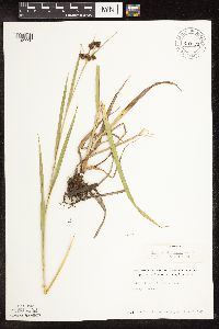 Scirpus atrovirens Willdenow 670130[1105996]Westkaemper, Remberta s.n.1973-07-16 United States, Minnesota, Stearns, Stearns Co. St. Stephen.;;N;;, 45.717167 -94.326173 |
MIN:Plants | 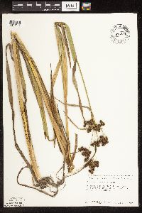 Scirpus atrovirens Willdenow 676317[1106017]Ownbey, Gerald 50071975-07-24 United States, Minnesota, Koochiching, Koochiching Co.; 10.5 mi. east of Northome. T 151 N, T 27 W, sec. 25;Pine Island State Forest;151N;27W;25, 47.869139 -94.048527 |
MIN:Plants | 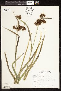 Scirpus atrovirens Willdenow 687330[1106063]Wheeler, Gerald; Glaser, Paul 17591977-06-27 United States, Minnesota, Itasca, Directly under the bridge where hwy. 169 crosses the Mississippi River in Grand Rapids.;;055N;25W;21, 47.231866 -93.522768 |
MIN:Plants | 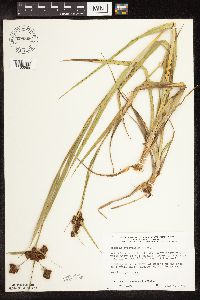 Scirpus atrovirens Willdenow 698366[1105969]Wheeler, Gerald; Glaser, Paul 31661978-07-05 United States, Minnesota, Beltrami, Red Lake Peatland. Ca. 9 mi. N of athe Waskish Airport on Rte. 72, a little over 0.25 mi. W of the road.;Red Lake Peatland Scientific Natural Area;156N;31W;36, 48.287244 -94.564235 |
MIN:Plants | 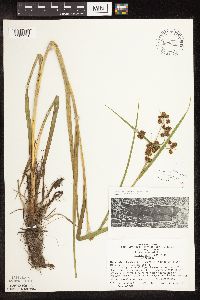 Scirpus atrovirens Willdenow 699673[1105971]Ziegler, S.; et al. 14331975-06-26 United States, Minnesota, Houston, Mississippi River Navigation Pool #8. Island on the W side of the main channel.;Upper Mississippi National Wildlife Refuge;103N;04W;36, 43.6825 -91.272199 |
MIN:Plants | 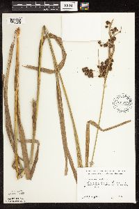 Scirpus atrovirens Willdenow 700582[1106049]Ownbey, Gerald 61151978-08-14 United States, Minnesota, Houston, Houston Co. T104N, R5W, SW1/4, Sec.33; 4.5 mi. W of the cemetary, W side of Hokah.;Dorer Memorial Hardwood State Forest;104N;05W;33, 43.767757 -91.442651 |
MIN:Plants | 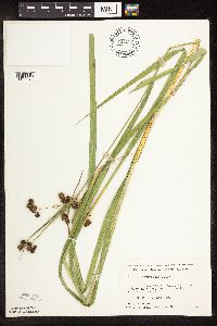 Scirpus atrovirens Willdenow 701122[1105970]Dorio, J. 5941977-07-20 United States, Minnesota, Morrison, Ripley Esker, ca. 3 mi. NE of Camp Ripley junction.;Ripley Esker Scientific Natural Area;042N;31W;19, 46.106283 -94.30299 |
MIN:Plants | 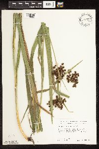 Scirpus atrovirens Willdenow 708408[1106035]Ownbey, Gerald 64701979-09-13 United States, Minnesota, Washington, Washington County ... T 30 N R 20 W Sec. 14 NW1/4, 1.5-2.0 mi northeast of Stillwater ... along St. Croix River.;Saint Croix National Riverway;030N;20W;14, 45.090515 -92.777311 |
MIN:Plants | 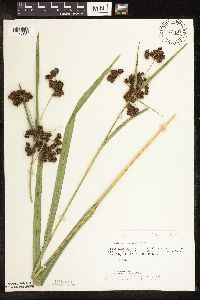 Scirpus atrovirens Willdenow 721197[1106061]Lustig, K. 9801979-08-21 United States, Minnesota, Sherburne, Clear Lake-Mississippi Scenic and Recreational River SNA: 12 mi. SE of St. Cloud.;Clear Lake Scientific Natural Area;034N;30W;, 45.446339 -94.043783 |
MIN:Plants | 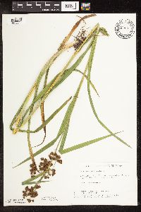 Scirpus atrovirens Willdenow 722537[1106069]Lustig, K. 6501979-07-05 United States, Minnesota, Anoka, Anoka County...Boot Lake SNA: 18 Mi. SE of Cambridge. Sec. 17, 18, 19, 20, T33N R22W;Boot Lake Scientific Natural Area;033N;22W;00, 45.340658 -93.081463 |
MIN:Plants | 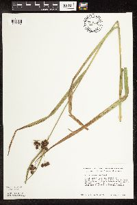 Scirpus atrovirens Willdenow 727244[1106037]Smith, Welby 33741980-08-17 United States, Minnesota, Wright, Wright Co. Between hwy. 55 and the Soo Line Railroad tracks, ca. 1/4 mi. NW of the springs wayside.;;119N;25W;15, 45.115773 -93.817185 |
MIN:Plants | 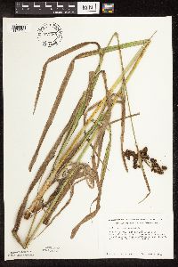 Scirpus atrovirens Willdenow 727269[1106064]Smith, Welby 36101980-09-01 United States, Minnesota, Wright, Wright Co.; About 5 1/2 mi. S of Clearwater. NE1/4 of NE1/4 of sec. 34, T 122N R 27W;Suconnix Wildlife Management Area;122N;27W;34, 45.332932 -94.065982 |
MIN:Plants | 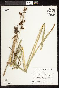 Scirpus atrovirens Willdenow 729824[1106024]Phelps, V. 1821980-08-12 United States, Minnesota, Pine, Pine Co. Kettle River Natural Area: 5.5 mi. E of Hinckley. T41N R20W SW1/4 SW1/4 NW1/4 sec.23;Kettle River Scientific Natural Area / Sandstone National Wildlife Refuge;041N;20W;23, 46.018609 -92.835797 |
MIN:Plants | 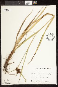 Scirpus atrovirens Willdenow 734378[1106058]Cross-Cella, J. 2831980-08-27 United States, Minnesota, Becker, Green Water Lake Natural Area: 5 mi. W of Ponsford.;Greenwater Lake Scientific Natural Area / White Earth Indian Reservation;141N;38W;33, 46.983894 -95.497699 |
MIN:Plants | 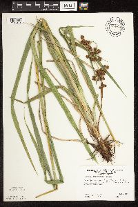 Scirpus atrovirens Willdenow 744022[1105963]Ownbey, Gerald 65841980-07-11 United States, Minnesota, Clearwater, Iron Springs Bog. Rte. 200, ca. 2 mi. E of Lake Itasca P.O.;Iron Springs Bog Scientific Natural Area;143N;36W;, 47.19557 -95.233216 |
MIN:Plants | 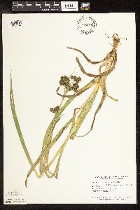 Scirpus atrovirens Willdenow 746171[1106047]Smith, Welby 45211981-06-25 United States, Minnesota, Wright, Wright County ... The southwest arm of Pelican Lake, about 5 mi. northeast of Buffalo. NW1/4 SE1/4 sec. 12, T 120N R 25W;;120N;25W;12, 45.216197 -93.775961 |
MIN:Plants | 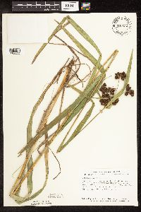 Scirpus atrovirens Willdenow 746252[1106059]Smith, Welby 52491981-08-04 United States, Minnesota, Fillmore, Fillmore Co. About 9 mi S-SE of Ostrander. SE1/4 of sec.27, T101N R13W.;;101N;13W;27, 43.522286 -92.379353 |
MIN:Plants | 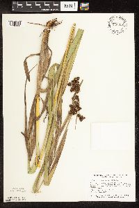 Scirpus atrovirens Willdenow 746305[1106060]Smith, Welby 55961981-08-26 United States, Minnesota, Mower, Wild Indigo Scientific and Natural Area. Ca. 1/2 mi. SW of the jct. of hwy. 56 and 2 in Brownsdale.;Wild Indigo Scientific Natural Area;103N;17W;9, 43.739626 -92.879241 |
MIN:Plants | 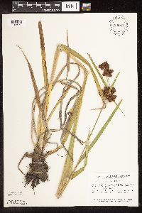 Scirpus atrovirens Willdenow 758047[1105975]Smith, Welby 66291982-07-04 United States, Minnesota, Wright, Between Albion Lake and hwy. 6, ca. 4 mi. SW of Maple Lake. NE1/4 SW1/4 Sec. 10, T120N, R27W.;;120N;27W;10, 45.217384 -94.064131 |
MIN:Plants |  Scirpus atrovirens Willdenow 758766[1105977]Smith, Welby 65141982-06-29 United States, Minnesota, Le Sueur, Le Sueur Co. On the W side of hwy. 23, about 2 mi NE of St. Peter, in the Minnesota Valley. NE1/4 NW1/4 sec. 11, T110N, Le Sueur Co. On the W side of hwy. 23, about 2 mi NE of St. Peter, in the Minnesota Valley. NE1/4 NW1/4 sec. 11, T110N, R26W.. 110N 26W 11, 44.348192 -93.919173 |
MIN:Plants | 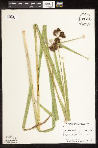 Scirpus atrovirens Willdenow 759280[1106025]Smith, Welby 67781982-07-17 United States, Minnesota, Dakota, Dakota County...In the Minnesota Valley, about 1/4 mi. N of Nicols. NE1/4 SW1/4 Sec. 18, T27N, R23W.;Fort Snelling State Park;027N;23W;18, 44.825884 -93.216999 |
MIN:Plants | 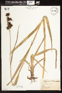 Scirpus atrovirens Willdenow 763346[1106011]Lugger, O. s.n. United States, Minnesota, Todd, Todd Co.;;;;, 46.092533 -94.8976 |
MIN:Plants | 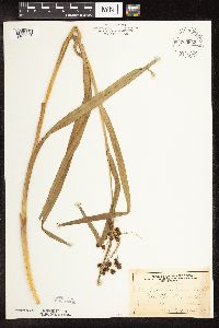 Scirpus atrovirens Willdenow 764632[1106088]Ballard, C. s.n.1892-07-00 United States, Minnesota, Nicollet, Courtland.;;109N;29W;, 44.239382 -94.311376 |
MIN:Plants | 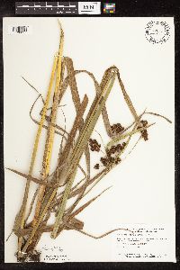 Scirpus atrovirens Willdenow 770422[1106057]Smith, Welby 86811983-08-16 United States, Minnesota, Mower, Lake Louise State Park, ca. 1.5 mi. NW of LeRoy. In a meadow on th N bank of the Iowa River.;Lake Louise State Park;101N;14W;28, 43.522099 -92.518958 |
MIN:Plants | 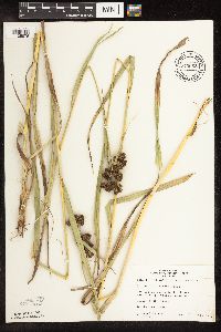 Scirpus atrovirens Willdenow 773062[1105976]Boe, J. 16101979-08-16 United States, Minnesota, Lake of the Woods, Lake of the Woods County ... near Norris Camp ... Sec.8 R35W T159N;Beltrami Island State Forest;159N;35W;08, 48.605309 -95.181076 |
MIN:Plants | 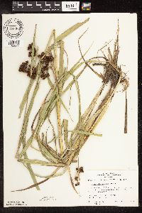 Scirpus atrovirens Willdenow 773382[1106062]Boe, J. 10661979-07-24 United States, Minnesota, Lake of the Woods, 1 mi. W of Graceton along hwy. 11.;;161N;33W;23, 48.75031 -94.860339 |
MIN:Plants | 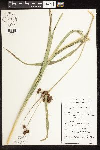 Scirpus atrovirens Willdenow 782304[1106002]Tenney, M. 5041982-08-04 United States, Minnesota, Fillmore, Forestville State Park. Fillmore Co. T102N R12W NE1/4 SW1/4 NE1/4 of sec.13;Forestville State Park;102N;12W;13, 43.637724 -92.219269 |
MIN:Plants | 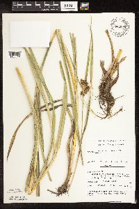 Scirpus atrovirens Willdenow 782595[1106014]Tenney, M. 327B1982-07-01 United States, Minnesota, Fillmore, Forestville State Park. Fillmore Co. T102N R12W SE1/4 NW1/4 of sec.24;Forestville State Park;102N;12W;24, 43.623411 -92.219152 |
MIN:Plants | 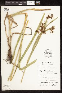 Scirpus atrovirens Willdenow 782661[1106048]Tenney, M. 3601982-07-06 United States, Minnesota, Winona, Whitewater State Park. Winona Co. T107N R10W Sec.29 SE1/4 NE1/4 NW1/4.;Whitewater State Park;107N;10W;29, 44.042035 -92.049333 |
MIN:Plants | 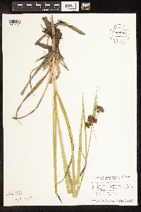 Scirpus atrovirens Willdenow 787572[1105972]Smith, Welby 105301985-06-29 United States, Minnesota, Dodge, Iron Horse Prairie Scientific Natural Area. Dodge County...Iron Horse Prairie State Scientific and Natural Area, about 1 1/2 mi S of Hayfield. NW1/4 SE1/4 of Sec.27, T105N R17W. 105N 17W 27, 43.8675 -92.8486111 |
MIN:Plants | 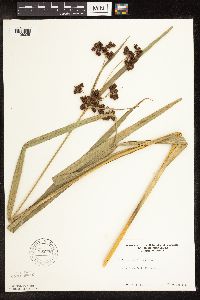 Scirpus atrovirens Willdenow 795730[1106029]Sanford, J. s.n.1947-08-00 United States, Minnesota, Clearwater, Itasca State Park; Headwaters.;Itasca State Park;143N;36W;, 47.19557 -95.233216 |
MIN:Plants | 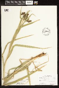 Scirpus atrovirens Willdenow 804908[1105992]Ordway, E. 141976-06-21 United States, Minnesota, Pope, Strandness Prairie. Pope County ... 4 mi. N Starbuck.;Strandness Prairie, The Nature Conservancy;125N;38W;06, 45.665152 -95.500112 |
MIN:Plants | 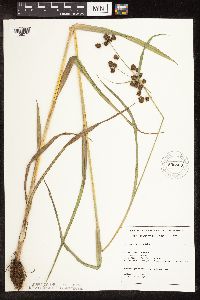 Scirpus atrovirens Willdenow 805805[1106071]Almendinger, J. MCBS-2041987-07-01 United States, Minnesota, Washington, Washington Co.; Brown's Creek (MCBS-#204); Stillwater; T30N R20W SE1/4 NW1/4 of sec.21; N side Brown's Creek, E of Cross Washington Co.; Brown's Creek (MCBS-#204); Stillwater; T30N R20W SE1/4 NW1/4 of sec.21; N side Brown's Creek, E of Cross residence; at N edge town.. 030N 20W 21, 45.071961 -92.812692 |
MIN:Plants | 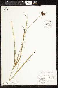 Scirpus atrovirens Willdenow 805850[1106051]Cholewa, A. 18371989-09-07 United States, Minnesota, Dakota, Dakota Co. "Nicols Fen", ca. 100 yds. NE of the jct. of Cedar Ave. and Chicago Northwestern RR. T27N, R23W, Sec 18;Fort Snelling State Park;027N;23W;18, 44.825884 -93.216999 |
MIN:Plants | 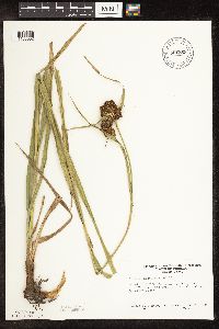 Scirpus atrovirens Willdenow 806863[1106032]Ownbey, Gerald 72861988-07-29 United States, Minnesota, Houston, Houston Co. 2 mi E of Mabel. Along Riceford Creek.;;101N;07W;19, 43.536869 -91.720469 |
Google Map
Google Maps is a web mapping service provided by Google that features a map that users can pan (by dragging the mouse) and zoom (by using the mouse wheel). Collection points are displayed as colored markers that when clicked on, displays the full information for that collection. When multiple species are queried (separated by semi-colons), different colored markers denote each individual species.